Using the application developed by Link Technologies SA the passenger will be able to be informed in real time of the positions of the vehicles (buses or pulleys) of each selected line on a map, the landing of the next vehicle, the closest stop from the position and the optimal route that can so that they plan their journeys in a timely manner without unnecessary waiting at stops.
The capabilities of the application
By entering the main menu of this software, the user can find the following sections:
Nearest stops (automatically indicates where the nearest bus or trolley station is located).
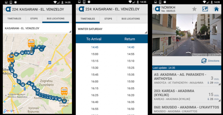
Bus locations (the location of buses on a map in real time).
Arrivals (information on bus arrivals of all lines at stops).
Optimal route (through which one can search for the optimal route that can be followed by using MMM from where it is located).
Lines (all bus and trolleybus information is provided).
News (communications on urban transport and not only).
Every user can store in their Favorites the most commonly used stops, so they automatically find all the routes they travel in real time to make it easier to plan their journeys.